


Advertisement
Advertisement
Advertisement
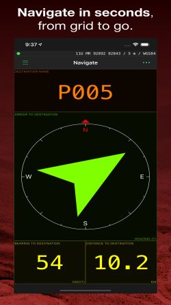
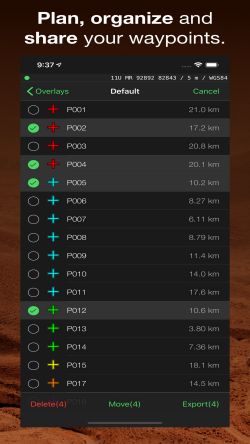
MilGPS is an advanced navigation tool for MGRS / USNG that is trusted by soldiers, search and rescue personnel and other professional navigators worldwide. View your current position and navigate to a waypoint in seconds. Or use the powerful and intuitive mapping and overlay features to plan and organize your navigation.
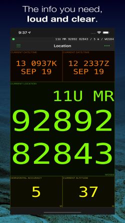
Simple and intuitive interface. Easily convert between position formats using the Add Waypoint screen, and support angle/mil angle with the option of true, magnetic or grid north reference. Supports altitude in feet/meters and distance in imperial/metric/nautical miles.
Why choose MilGPS compared to other applications?
-MilGPS is in active development and testing (since 2010)
-MilGPS is crafted by independent developers
-MilGPS emphasizes accuracy, simplicity, ease of use and stability
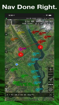
Mapping to view current position and waypoints on a map with custom smooth scrolling grid overlays (MGRS / USNG / OSNG / UTM)
-Locate new waypoints and measure distances/ bearings using crosshairs
-Select from standard / satellite / hybrid / blank map types
-Grid overlay with grid markers for 100km, 10km, 1km, 100m square
-The map can be set to follow your current position and/or direction.